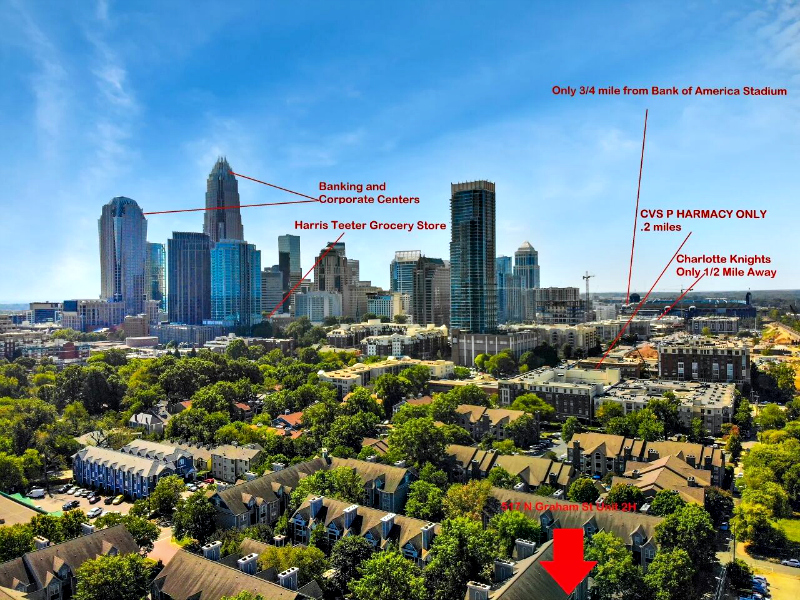
The biggest benefit of utilizing drone photography is displaying where the subject property is located compared to nearby attractions, amenities, parks, airports, etc. An aerial perspective is by far the best way to show the entirety of the subject property vs attractions.
Accuracy:
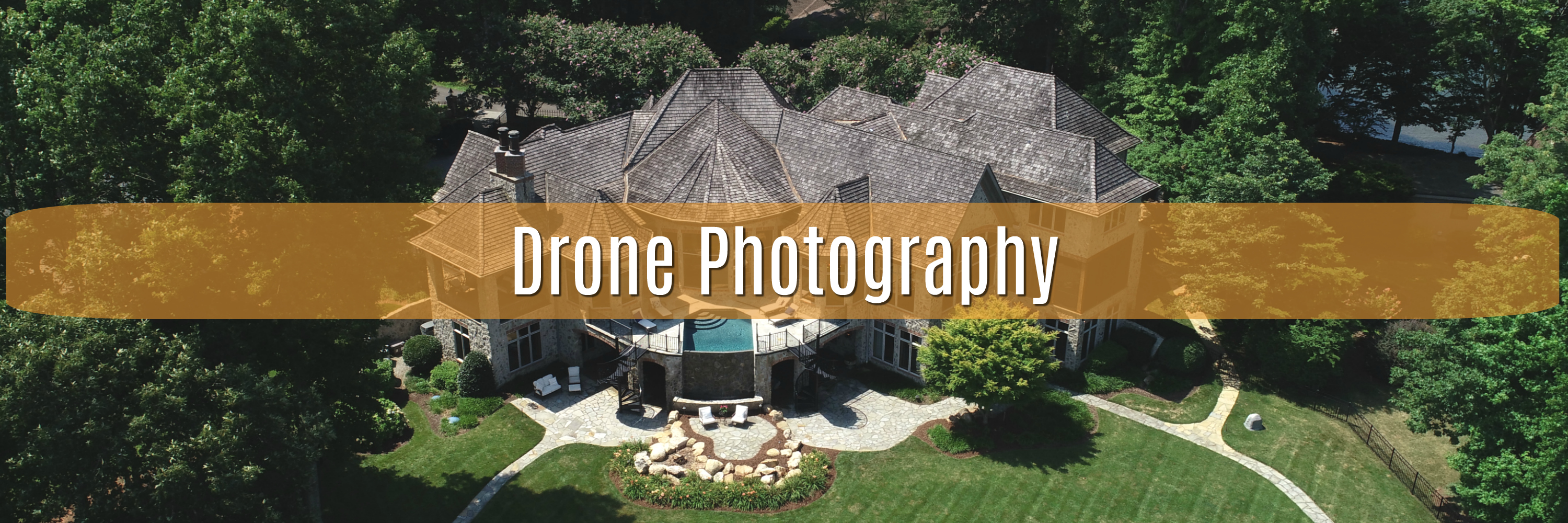
Drone Photography is best used to display inaccessible features of a property, such as newly built docks, chimneys, pools, outdoor kitchens,installed roofs, gutters, vents, etc. These pictures are critical to give a prospective client views that photography taken from ground level cannot achieve. These aerial images coupled with descriptions and icons will provide a nice layout of the property along with providing some mystery of where some things lie. Drone photography provides a more accurate story of what the property is like.
Return on Investment Utilizing Drone Photography:
According to RISMedia, “listing agents who use drones for real estate could see an increase in listings as high as 73% and deal closing increases as high as 68%”. Sold by Air offers that, “83% of home sellers prefer to work with an agent using drones.” Realtors using drone photography will have a competitive advantage over listings without it.